To begin with I mention that in my office in kibbuts Massada there is an areal image of the whole kibbuts, with a pretty good resolution, revealing many minute details,the areal image serving for agricultural planning. Before Google Earth, as anyone in Israel who needs such aerials, we buyed it for cash. Today Google Earth brings a cheap alternative for every surfer on the Internet, and perhaps for many purposes, seeing the satellite image of Massada on an LCD monitor with an 1600-1050 native resolution is a very good alternative, and so it was for the al-Aqsa Martyrs Brigade in Gaza using the satellite images of Sderot on a laptop for targeting their rockets on the town, launching them from inside the Gaza strip, and I cannot blame them for using Google Earth brought to all of us.
Now, this manner of using Google Earth cleared the way to condemn her for promoting terror. Many newspapers in their headlines do it as a matter of fact. For example, “Terrorists ‘use Google maps to hit UK troops’, I quote…. “This is evidence as far as we are concerned for planning terrorist attacks,” said an intelligence officer with the Royal Green Jackets battle group. “Who would otherwise have Google Earth imagery of one of our bases?”… see here, or in a Nytimes article “4 Men Accused of Plot to Blow Up Kennedy Airport Terminals and Fuel Lines”, published: June 3, 2007, I quote..” But officials said the four men determined to carry out their attack, having conducted “precise and extensive” surveillance of the airport using photographs, video, the recollections of Mr. Defreitas and satellite images downloaded from Google Earth.” see here.
The “information Week” from Jun 4, 2007, ask the readers ” Will Terrorists Use Google Earth?“. It is instructive to read the readers response. I quote one of them..”This is really a waste of time, as all of the information that Google supplies can be found in (multiple) other places online and in hard copies. So if we shut down Google Maps… um, they’d use the source images or another service. Just because Google makes it easy to acquire the knowledge necessary to make a terroristic plot doesn’t mean that it is the only way. It’s also not always the best way to find information for a terrorist plot as they may be worried about their searches sending up a red flag.I guess you just ran out of stuff to write about and had to make your quota”, see here.
Factually,The Guardian fromt Tursday October 25, 2007 shows how terror uses Google Earth.
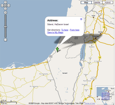
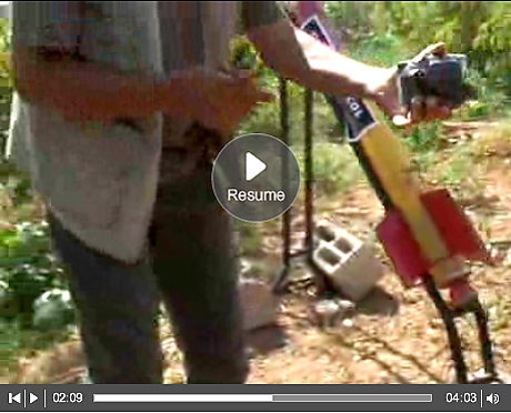
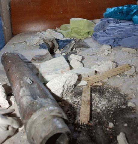
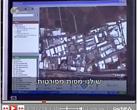
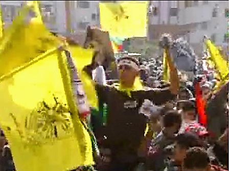
“Palestinian militants are using Google Earth to help plan their attacks on the Israeli military and other targets, the Guardian has learned… Members of the al-Aqsa Martyrs Brigade, a group aligned with the Fatah political party, say they use the popular Internet mapping tool to help determine their targets for rocket strikes. “We obtain the details from Google Earth and check them against our maps of the city centre and sensitive areas,” Khaled Jaabari, the group’s commander in Gaza who is known as Abu Walid, told the Guardian. Abu Walid showed the Guardian an aerial image of the Israeli town of Sderot on his computer to demonstrate how his group searches for targets.”…”Abu Walid showed the Guardian an aerial image of the Israeli town of Sderot on his computer to demonstrate how his group searches for targets”… see more.
To illustrated the Guardian article I extracted from the video clip the following pictures.


One Reply to “Sderot near Gaza and Google Earth”
Comments are closed.